

Corney Brook
Cape Breton Highlands National Park
The last bridge on the Corney Brook Trail is currently out of service. For your safety, please do not attempt to cross the brook.Temporary Bridge Closure
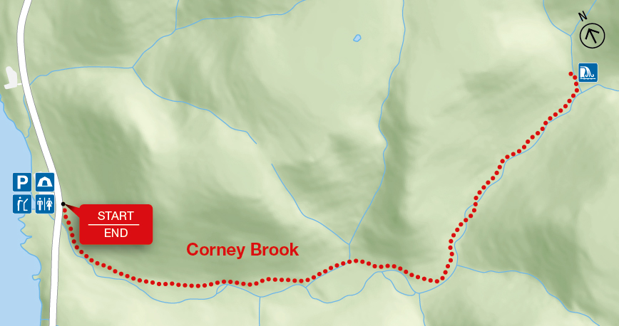
Follow a meandering brook through a hardwood forest to a small waterfall that marks the end of the trail. You are actually in a box river canyon – there is only one way out! Keep a watch out for wildlife – a variety of birds, snowshoe hare or maybe even a moose. Local Acadians know this brook as "Rivière à Lazare".
| Length | 6.5 km / 4 mi (return) |
    |
| Rating | Easy  |
|
| Elevation | 30 - 170 m (100 - 560 ft) | |
| Time | 2 hours | |
| Significant features | Acadian forest, river canyon, waterfall Cliffs along river edge near beginning of trail. Suitable for most skill levels. |
|
| Trailhead | Across from the Corney Brook Campground Lat: 46.725580 Long: -60.924757 |
Related links
- Acadian
- Salmon Pools
- Le Chemin du Buttereau
- Le Buttereau
- Le vieux chemin du Cap-Rouge
- Skyline
- Bog
- Benjie's Lake
- Fishing Cove
- MacIntosh Brook
- Lone Shieling
- Aspy
- Mica Hill
- Jack Pine
- Neils Brook Beach
- Jigging Cove Lake
- Green Cove
- Mary Ann Falls
- Broad Cove Mountain
- Warren Lake
- Franey
- Clyburn Valley
- Middle Head
- Freshwater Lake Look-off
- Freshwater Lake
- Date modified :