
Detailed maps of the Mingan Islands
Mingan Archipelago National Park Reserve
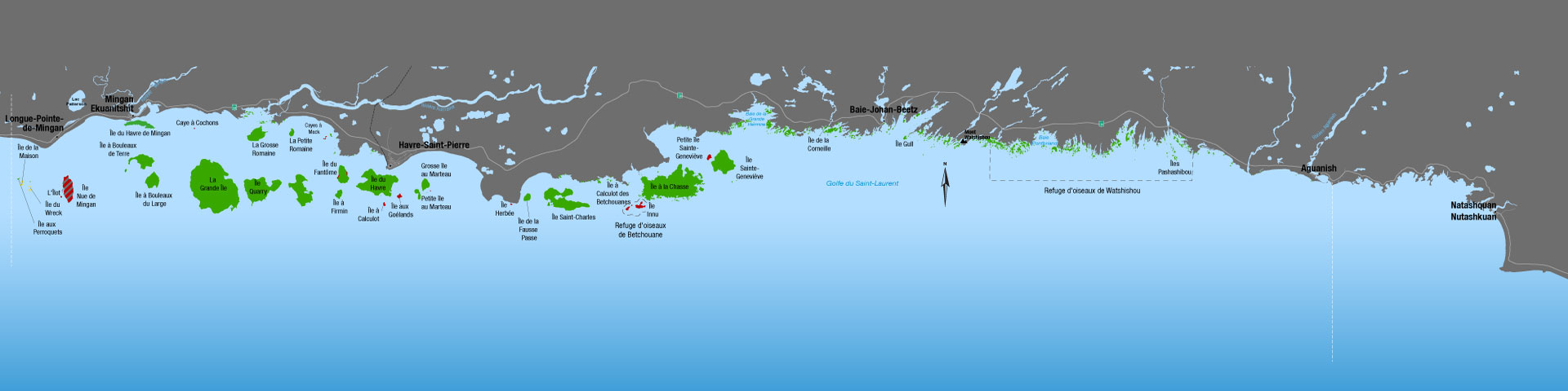
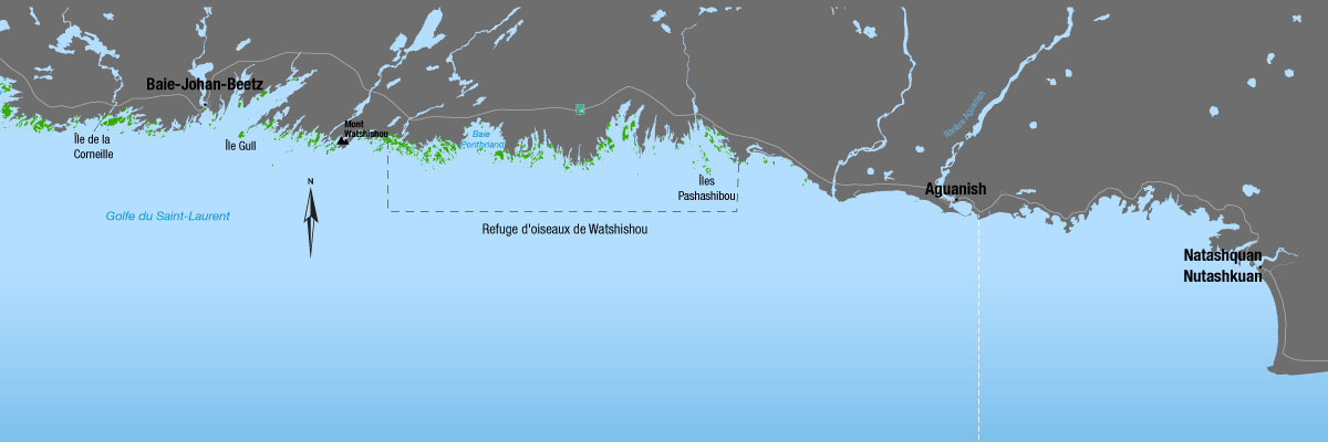
Two different sectors in the park
The first sector includes most of the islands found in the Western and Central regions of the archipelago (the park's most frequented and well-used area). This portion contains the majority of the park's limestone islands and monoliths. It is situated between Île aux Perroquets, facing Longue-Pointe-de-Mingan, and Île Sainte-Genevieve.

Map of the Western and Central sectors of the Archipelago
The second sector, the Eastern region of the park, comprises most of the granite islands, islets and keys-nearly 1000 in total-found east of Île Saint-Genevieve and extending to the mouth of the river Aganus, near Aguanish.
Map of the Eastern Sector of the Archipelago
Detailed Maps in PDF format
Campgrounds
Grande Île
- Havre à Petit-Henri (PDF, 2 Mb)
Île à la Chasse
- Havre à Landry (PDF, 2.1 Mb)
Île du Havre
- Anse des Noyés (PDF, 2 Mb)
- Havre au Sauvage (PDF, 2 Mb)
Île Niapiskau
- Anse du Noroit (PDF, 2 Mb)
Île Nue de Mingan
- Île Nue de Mingan (PDF, 2.4 Mb)
Île Quarry
- Baie Quarry Est (PDF, 1.9 Mb)
- Baie Quarry Ouest (PDF, 1.9 Mb)
Hiking Trails
- Île du Havre (PDF, 9 Mb)
- Île Quarry (PDF, 11 Mb)
- La Grande Île (PDF, 14 Mb)
- Île Nue de Mingan (PDF, 12.5 Mb)
- Île Niapiskau (PDF, 2.3 Mb)
- Île du Fantôme (PDF, 1.7 Mb)
- Grosse Île au Marteau (PDF, 7.8 Mb)
- Petite Île au Marteau (PDF, 6.3 Mb)
- Île aux Perroquets (PDF, 5.8 Mb)
More information on the Islands
- Date modified :